I grew up hiking the mountain trails of Georgia, Tennessee, and North Carolina every summer. Occasionally those hikes would intersect with the Appalachian Trail. I remember feeling a bit in awe of the trail and of the thru-hikers who traversed this path from Georgia to Maine. It seemed somewhat mysterious to my young mind.
Then I moved to Georgia. I read several books by and about AT thru-hikers. I took several hikes on and around this famous foot path. It lost a little of its mystery. But I am still amazed and inspired by the thousand of thru-hikers who are drawn from around the world to walk this rocky path over and through these mountains.
Recently, our homeschool hiking group expressed an interest in hiking Springer, and I seized the opportunity to visit this internationally famous destination that lies practically in our own backyard.

Details:
- Name: Benton MacKaye Springer Mountain Loop
- Specs: 5.4 miles including a side trip to summit Springer. 846 ft. elevation gain. Moderate.
- Address: Springer Mountain Parking Lot, FS Road 42, Ellijay, GA
- Parking fees: $0
- Foot Traffic: Busy. You will encounter plenty of other hikers even on weekdays.
- Restrooms: None at the trailhead. There are two privies at the Springer Mountain Shelter/camping area. There is no running water.
- Cell Service: Spotty
- Time Required to Complete: Approximately 3-3.5 hours depending on the length of your lunch break.

Trail Journal
Getting There
There are several ways to reach the Springer Mountain parking area. After consulting with the rangers at the Chattahoohee-Oconee National Forest Service office, I chose to take Doublehead Gap Road to Forest Service Road 42 and travel south rather than traveling north from Nimblewill Church Road. The lower route is reportedly much more washboard-y.
The gravel on the north end of FS 42 was not bad on the day we went though there had been significant rainfall the week before. There were a few dips and potholes, but no major washouts. A car could traverse it carefully, but trucks and Jeeps had no trouble. Even small to mid-size SUVs with only moderate clearance had no problem. It did take approximately 1.5 hours to reach the trailhead from Dahlonega. This trailhead is not easily accessed.
The Hike
It was a cool spring day with temperatures in the 50s. There were wind advisories for the lower elevations with expected gusts of 35 mph. The parking lot was extremely windy and cold. We intended to hike the loop counter clock-wise and set out accordingly.
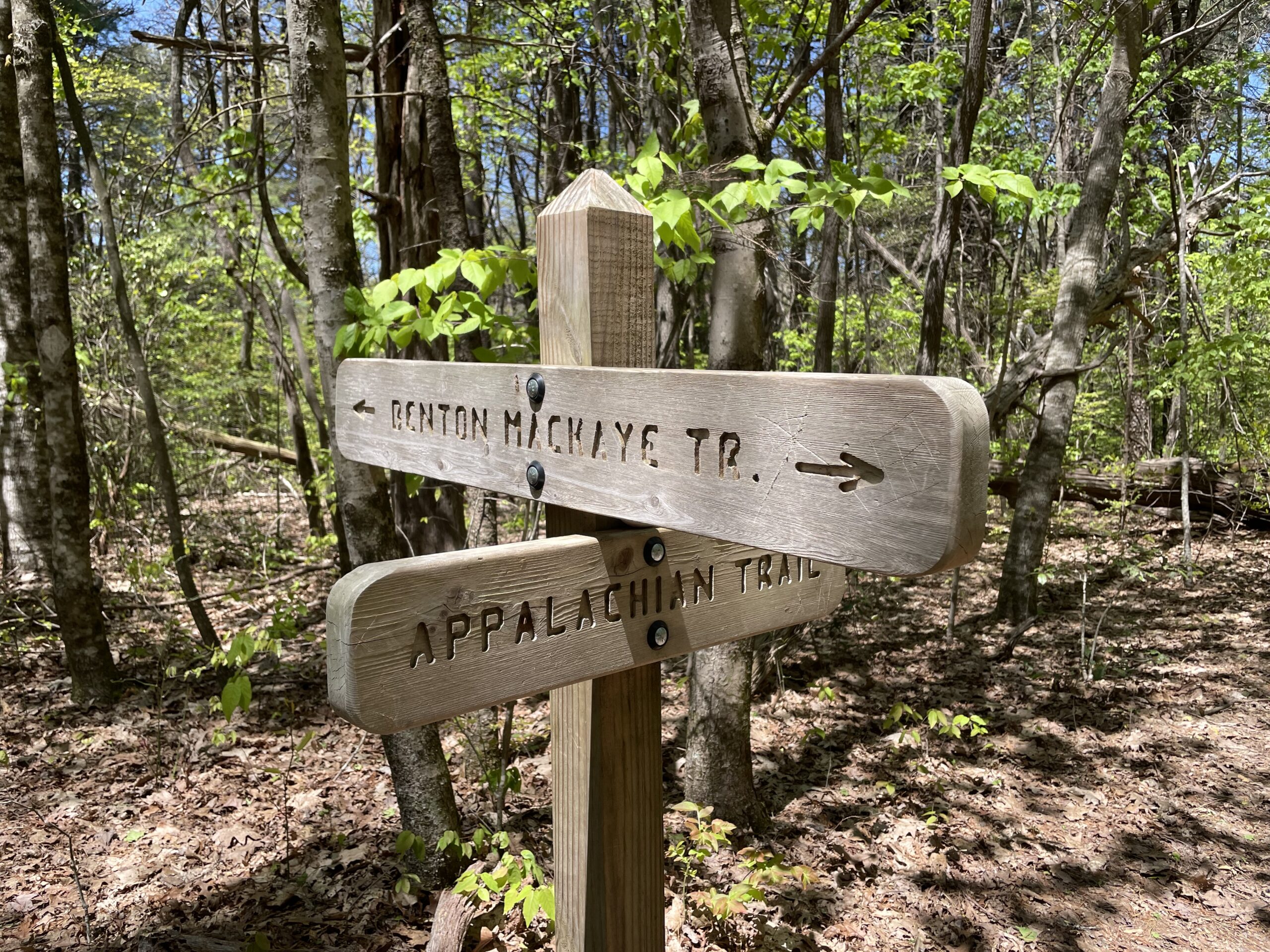
The trail was quite rocky, but the incline was not terribly steep. As we hiked, the trail wound to a point where we had some shelter from the wind. We warmed up quickly with the sunlight and exercise. We chose to pass the intersection with the Benton MacKaye Trail (BMT) so that we could summit Springer. However our group needed to stop at the privies before proceeding.
Mountain ridges always have more wind than lower elevations. As we passed descending hikers, they encouraged us to brace ourselves against the wind as we approached the top. We did. It was cold up there but not unbearably so. Our hands did not shiver uncontrollably as we posed for photos, signed the log-book, and just basked in the experience of standing where so many hikers have stood before us.


The BMT Loop
We descended the summit and turned right onto the BMT. This trail was less rocky and not as steep. While it was definitely quieter and much less travelled than the AT, the path was still easily distinguishable. We appreciated the obviously new signposts along this route. (Thank you, volunteer trail crews!) Though the white diamond blazes could use some touch-ups, we had no trouble navigating.


This trail was more sheltered from the wind. Along the way we saw mayapples and trillium. We chose to stop at Owens Vista for a relaxing lunch. After the break, we encountered three easy water crossings. (No water shoes needed.) Several members of our group passed right by a snake coiled at the edge of the trail without ever noticing him. Eventually, we reconnected with the AT and headed back to the parking area.
Overall Experience
This was a beautiful loop to hike in springtime. It was a joy to discover the delicate trillium and lady slipper flowers. Owens Vista provided a comfortable, sheltered lunch stop. The trail was enough to raise our heart rates a bit but not so much that we were worn out for the rest of the day. We conversed with hikers from other parts of the country. Highly recommended!
